3D geomechanical model of the field
Software for geomechanical modeling
Digital modeling of a hydrocarbon field
data analysis
import substitution
PRODUCT OVERVIEW
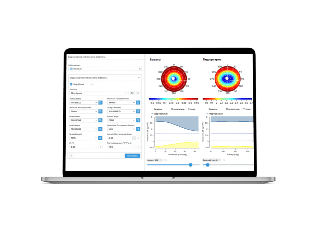
A platform for geomechanical modeling of the wellbore surroundings. It combines subsurface rock condition data, GIS data, and presents them in a 3D layout of the reservoir. It facilitates quick integration with other industrial solutions through a unified data exchange format
INDUSTRIES
PETROLEUM
Addresses


Determination of mechanical properties of drilled rocks
Minimize wellbore instability (preventing stuck pipe, narrow hole, loss of circulation, sidetracks and well collapse)
Forecast of the maximum safe drawdown value before reservoir compaction

Increasing the reliability of hydraulic fracturing modeling

Fault and Overburden Stability Analysis

>50%
non-productive time when drilling a well is reduced
the cost of drilling a well is reduced
>20%
Effects
PRODUCT BENEFITS
Developed domestically
Improves simulation efficiency
Digital twin of the field


USE CASES
13.09.2022 / media.innopolis.university
6.10.2017 / media.innopolis.university
CLIENTS and partners


FAQ
Интерпретация сейсмических данных, геологическое моделирование, геомеханическое моделирование, моделирование ГРП, гидродинамическое моделирование.
Поддержка всех общепринятых форматов данных — Las, Irap, Earthvision, CPS3, Grdecl, Segy и других.
Продукт позволяет комплексно решать проблемы геомехаников, строить как классические 1D-модели так и 3D-геолого-гидро-геомеханических модели с возможностью выдачи полноценных рекомендаций другим подразделениям.
Платформа свободно интегрируется со всеми популярными системами геолого-геофизического моделирования путем поддержки общепринятых форматов передачи данных.
Leave your request
for the product
for the product

E-mail
Telephone
Newsletter for those who want to know everything and a little more about technology

