About center
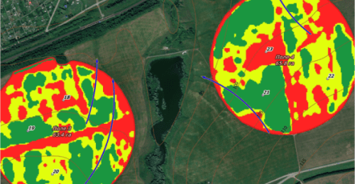
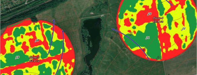
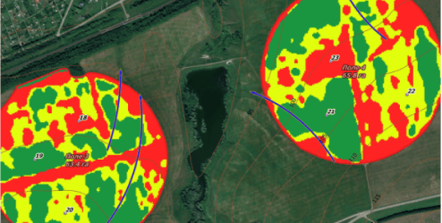
We deploy geographic information systems (GIS) for agriculture and the oil and gas industry, perform environmental monitoring, validate and verify greenhouse gas emissions, and establish spatial standards.
Additionally, we generate 4D models of urban areas and regions, alongside offering geomarketing services.
SKILLS
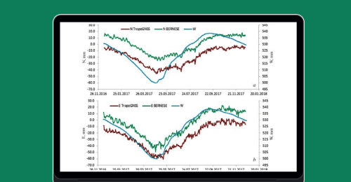
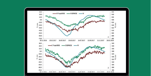
Cloud services for remote sensing data analysis
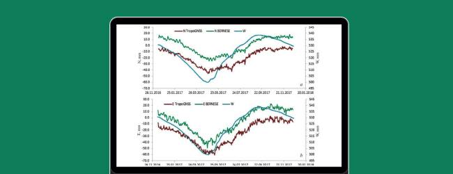
Development of national remote sensing standards
Corporate GIS systems
4D modeling
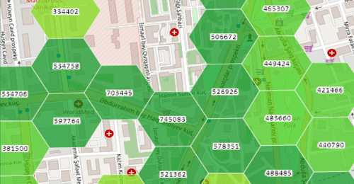
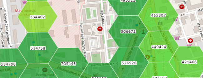
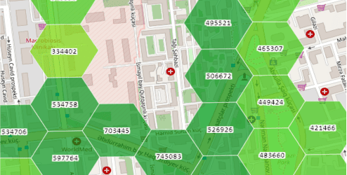
Geomarketing
30
projects
5
flagship products
90
experts and developers
Products


Diana Nizamova
Head of the center
The center's team has been operational since 2017 and has successfully executed over 30 large-scale projects nationwide.
We employ a modern technology stack and customize tools to meet the specific requirements of our clients.
CLIENTS AND PARTNERS


blog
29.12.2020 / MEDIA.INNOPOLIS.UNIVERSITY
16.10.2020 / MEDIA.INNOPOLIS.UNIVERSITY
12.12.2018 / MEDIA.INNOPOLIS.UNIVERSITY
E-mail
Telephone
Newsletter for those who want to know everything and a little more about technology


Geographic information systems
The page is under development